Weggis Rigiblick

- 1:17 h
- 4.21 km
- 164 m
- 164 m
- 435 m
- 599 m
- 164 m
The approximately half-hour ascent from the village crossroad along Rigiblickstrasse is rewarded with a magnificent view. Around Rigiblick, you can complete a small circular route. The barbecue area at Rigiblick offers a unique panorama of Lake Lucerne and the Alps.

Weggis Vitznau Rigi
Waypoints


Good to know
Pavements
Unknown
Street
Trail
Best to visit
suitable
Depends on weather
Directions
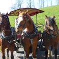
From the boat station we walk to the village square and ascend the Rigiblickstrasse (between the schoolhouse and the parish church). At the top, it turns sharply to the left (signpost to Kurhaus St. Otmar). After the last house on the right (by the parking lot), the path first leads along the forest edge and then through the forest in a large arc to the Rigiblick viewpoint. There is also a barbecue area there. We continue on the circular route and soon reach the forest edge above the parking lot again. Now we go left, across the meadow to the hiking trail, which passes the horse stable to the small brook. Now we turn left, cross the roundabout and walk along Luzernerstrasse past the Neubühl market. Just before the Alpenblick Hotel, we turn right into Parkstrasse and stroll through the community park down to the shore of Lake Lucerne and further to the Weggis boat station.
Tour information
Loop Road
Directions & Parking facilities
From the Küssnacht motorway exit, follow the main road to Weggis.
There are parking facilities in the village center. CHF 8.00 per day.
Weggis can be reached from Lucerne by boat or via Küssnacht by train and bus.
Author
Tourist Information Weggis (Luzern Tourismus AG)
Organization
Weggis Vitznau Rigi
Nearby