


- 3:50 h
- 10.34 km
- 691 m
- 691 m
- 435 m
- 1,126 m
- 691 m
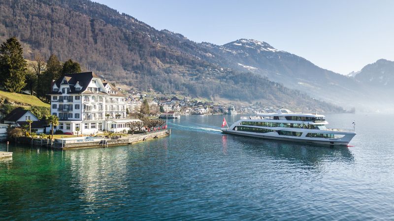
- Start: Weggis boat station
- Destination: Weggis boat station
The hike on the southwest slope of the Rigi leads to the edge of the Seebodenalp, to the Räb alpine farm.

Waypoints
Start

Good to know
Best to visit
suitable
Depends on weather
Directions
The starting point is at the boat station in Weggis. From the village crossing, follow Rigiblickstrasse (between the schoolhouse and the parish church) and Untereggistrasse straight ahead. At the "Schlosshof" farmhouse, keep right and you will pass other farms on the asphalt road. After a few bends, you will reach the pretty house at Unterstutzberg. After crossing the meadow, you will pass through a short stretch of forest. The path continues to climb until you reach an asphalt road. Cross this and continue up through the forest. Soon, the Räb alpine farm comes into view. The effort is rewarded with a fantastic view of Lake Lucerne and the lowlands.
After a refreshment in the Räbalp, the path leads along the Rigi slope to Bergli and Schlieriberg. Now the descent becomes steeper - along a hedge - to Tannenberg, Telli and back to the village centre of Weggis.
Tour information
Loop Road
Stop at an Inn
Directions & Parking facilities
From the Küssnacht motorway exit, drive to the village centre of Weggis.
The "Dorf" parking garage is located on Rigistrasse, 200 meters from the lake. Price CHF 8.00
From Lucerne by boat or via Küssnacht by train and bus to Weggis.
Author
Tourist Information Weggis (Luzern Tourismus AG)
Organization
Tourist Information Weggis
Author´s Tip / Recommendation of the author
A break in the Räbalp - great view, fresh drinks, delicious food.
Nearby


